Welcome to the TūHOE blog
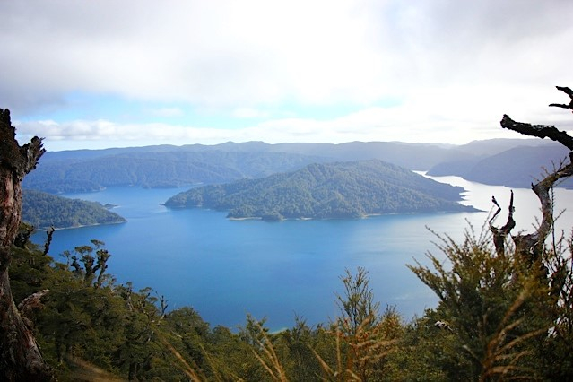
Lake Waikaremoana

Ko Te Waikaukau o na Mātua Tupuna
Ko Panekire Te Mauna
Ko Haumapuhia Te Tipua
Ko Waikaretaheke Te Awa
Ko Te Umuariki Te Tanata
Ko Tūhoe Te Iwi
Remote, rugged, immense, the forests of Te Urewera contains the largest forested wilderness remaining in the North Island – 213,000 hectares. It is famous for its lakes and forested beauty and as the homeland of Ngai Tūhoe, who have lived around its shores for centuries.
In the southern part of Te Urewera lie two of the areas treasures, Lakes Waikaremoana and the smaller Lake Waikareiti. Tūhoe say Lake Waikaremoana was formed centuries ago by Haumapuhia, a young woman who was transformed into a taniwha (supernatural being) by her father for disobeying him. In her struggles she gauged out the shape of what became the lake.
Scientists have a different version, saying the lake was formed 2,200 years ago by a huge landslide, which blocked a narrow gorge along the Waikaretaheke River. Water backed up behind this landslide to form a lake up to 256 metres deep, the North Island’s deepest. In places the drowned forest can be seen deep beneath the clear waters.
The lake is almost 600 m above sea level, with a cooler, wetter and more changeable climate than lower altitudes – snow often falls in the winter months.
A popular tourist destination, there is holiday park on th
e lakeshore and public huts and campsites around its 46 km Lake Walk.
Apart from walking the lake track or the many other short walks in the area, Waikaremoana is also popular with hunters and fishers. Brown and rainbow trout are in the lake in good numbers; and there is also good deer hunting.
Many of the 650 species of native plants of Te Urewera can be found in the Waikaremoana region. Nearby Manuoha mountain is the highest point in Te Urewera at 1392 metres above sea level. It is just above the tree-line with just stunted alpine vegetation and views on a clear day across the central North Island to the peak of Mount Tongariro, south of Lake Taupo.


